
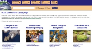
The Digital Library for Earth System Education (DLESE) has updated and released a new version of the DLESE Earth Science Literacy Maps. The Maps are a great tool to aid the teaching and learning of Earth system science. They show relationships between concepts, how concepts at a given level connect with and emerge from concepts at prior levels, and link to related National Science Education standards information - all focused on Earth science concepts alone. (Both DLESE Earth Science Literacy Maps and NSDL Science Literacy Maps are based on the American Association for the Advancement of Science’s (AAAS) Benchmarks for Science Literacy, and utilize the NSDL Strand Map Service, an NSDL project).

Leave a Comment
* You can follow any responses to this entry through the RSS 2.0 feed.